

WATCH NOW
Watch on the app








California gets a break from wildfires thanks to El Niño but Mother Nature has another surprise in store
-
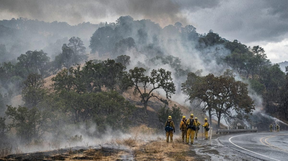
El Niño slows down the fires across Southern California while heavy rains alter seasonal conditions.
-
Recent downpours trigger flash flooding, mudslides, and debris flows across vulnerable burn scars in hilltop communities.
-
Santa Ana winds and dry vegetation keep fire danger active in areas lacking consistent autumn rainfall.
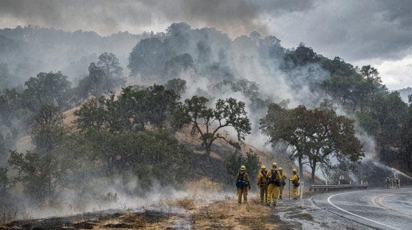
Abundant rainfall associated with a historically intense El Niño pattern transforms the immediate threat of wildfires in California, substantially lowering the likelihood of massive autumn conflagrations while simultaneously elevating secondary environmental threats like flash flooding, mudslides, and severe debris flows.
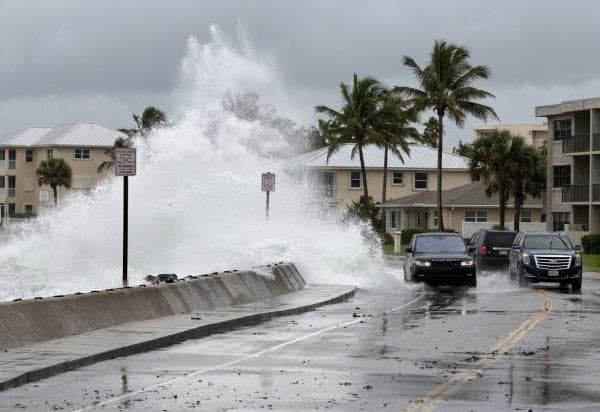
Simultaneously, emergency officials emphasize that recent storms caused severe roadway flooding along Highway 101 through Los Angeles and Ventura counties as well as Route 1 in San Luis Obispo County, leaving heavy rock deposits near Agua Dulce while a landslide partially blocked Highway 41 along the Central Coast.
Rain quenches dry brush to curb wildfires in California
Furthermore, meteorologist Matt Shameson from the US Forest Service confirms that autumn precipitation directly increases moisture levels in local grasses, shrubs and soil, proving how El Niño slows down the fires during critical weather shifts.
In light of this, this sudden moisture relief arrives shortly after the Norte Fire burned 24.8M square feet across Orange County, damaging or destroying at least 7 hillside structures in San Juan Capistrano and demonstrating how vulnerable the region remains when dry winds collide with unmoistened terrain outside peak activity months.
Along these lines, statistical records from the National Interagency Fire Center indicate that the average daily probability of a major wildfire in Southern California hovers around 22% during peak months in July and August, whereas in October that baseline risk drops to nearly 5% as long as accumulated moisture remains high and strong winds stay absent.
Regional weather differences and Santa Ana wind factors
Although storm remnants from Tropical Storm Rachel and Hurricane Marie previously deposited between 1 and 3 inches of rain across the Inland Empire, San Diego, and Orange counties, areas in Los Angeles and Ventura received less than 0.1 inches, showing that El Niño slows down the fires only where substantial precipitation falls.
Owing to these disparities, fire authorities like Battalion Chief David Acuña from CAL FIRE urge residents not to drop their guard, warning that high Fahrenheit temperatures combined with dry Santa Ana winds can quickly desiccate vegetation and reignite dangerous conditions before additional storms arrive.
Taking these precedents into account, emergency services maintain high alertness due to events like the Mountain Fire in Ventura County in November 2024 and the Los Angeles firestorm in January 2025, which proves why local agencies continually monitor residual risks associated with wildfires in California, especially since stronger Santa Ana winds typically occur during winter when 2 separate broad periods of moderate to heavy rainfall become necessary to eliminate large scale fire risks.
Ver esta publicación en Instagram
El Niño slows down the fires amid tropical system shifts
Tropical cyclone remnants reached Southern California for 3 to 4 consecutive years, compared to the historical frequency of once every 5 to 10 years, relieving drought conditions as El Niño slows down the fires on a cumulative regional scale.
Building on these hydrological trends, the 2025–2026 water year concluded on September 30 with 22.61 inches of accumulated precipitation (1.88 feet), reaching nearly 95% of the historical average according to official monitoring reports by the California Department of Water Resources, following 2 near normal water years in 2023–2024 and 2024–2025, marking the longest such streak since the 1990s.
Turning to winter projections, high altitude mountain snowpack accumulation measured in feet typically consolidates during winter months, meaning that at the end of October it does not yet serve as a seasonal indicator, although its future evolution remains vital for long term water availability and ecosystem moisture.
Burn scars trigger flooding, mudslides, and specialized municipal response
-
Extreme heat from blazes vaporizes organic matter and creates hydrophobic soil layers that repel water.
-
Heavy precipitation falling on recently burned areas increases the likelihood of severe landslides even as El Niño slows down the fires.
-
Meteorologists at the National Weather Service anticipate additional rain, potential thunderstorms and a low probability of tornadoes in Ventura before conditions dry out over the weekend.
-
The Los Angeles Fire Department reinforced swiftwater rescue units to counter mudslides across vulnerable burn scars.
-
Municipal crews under Mayor Karen Bass cleared more than 31K storm drains and drainage systems while reinforcing vulnerable hillside slopes, specifically targeting Pacific Palisades.
Under this shifting meteorological landscape, moisture accumulated from sequential tropical systems offers a welcome break from widespread conflagrations, forcing emergency agencies to redirect active surveillance toward emerging mudslide threats.
Ver esta publicación en Instagram
