

WATCH NOW
Watch on the app













Hurricane Genevieve may miss California but could still cause problems
- The tropical storm system advances with 250 km/h of sustained winds across the Pacific Ocean, triggering maximum alerts in Southern California.
-
Meteorological authorities record 11 feet in wave heights and dangerous rip currents along the beaches of San Diego and Los Angeles.
-
Experts confirm that the phenomenon remains far offshore and weakens progressively while crossing cooler marine currents.
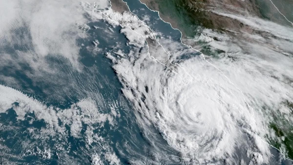
Hurricane Genevieve advances during the current month of the 2026 season while the National Hurricane Center monitors its dangerous evolution closely as it tracks far offshore over the northeastern Pacific Ocean, avoiding a direct landfall while sparking urgent preventive alerts along the U.S. coast of California thanks to coordination from the National Weather Service. Furthermore, the National Oceanic and Atmospheric Administration details that this tropical system reached Category 5 briefly before degrading to Level 4, driving destructive gusts that hit 250 km/h and mobilizing a massive wave of ocean energy toward Southern California beaches.
Meanwhile, civil protection agencies activate emergency protocols ahead of extreme marine conditions threatening public safety across coastal counties, recording unusually high surf that puts swimmers at imminent risk and challenges experienced mariners throughout the weekly cycle; however, meteorologists emphasize that the northwest movement of the cyclone toward cooler waters permanently cuts off its heat source, guaranteeing a gradual weakening that dissipates the severe threats tied to the advance of the system.
Ver esta publicación en Instagram
Trajectory and evolution of hurricane Genevieve
The advancement of the tropical storm system over the deep waters of the Pacific Ocean keeps the international scientific community on edge, because the phenomenon registers a remarkably rapid intensification that recalls historical records of past major pacific storms; consequently, specialists analyze every barometric and thermal variation to understand the atmospheric dynamics fueling high-magnitude sustained winds, which continue moving parallel to the coastline without touching the U.S. continental territory.
Equally, climate prediction centers release updated bulletins every 3 hours to warn about the forward speed of the storm, ensuring that harbor masters enforce strict restrictions on commercial and recreational navigation; therefore, continuous satellite surveillance confirms that interaction with cold marine currents drastically decelerates its internal structure during upcoming days, cementing a scenario of total dissipation far from inhabited areas of the coastline of the cyclone.
Coastal impacts and safety warnings
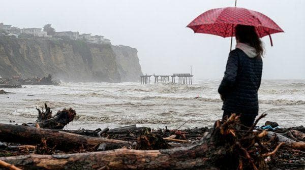
The beaches of Southern California experience severe hydro-meteorological disruptions from the early morning hours on Wednesday, presenting an extreme risk scenario due to the sudden formation of powerful rip currents that drag swimmers offshore; in such a way that lifeguard departments in San Diego, Orange and Los Angeles double their operational staff and post absolute prohibition red flags across all public beach access points.
Additionally, official measurements report wave heights oscillating between 3 feet and 6 feet that scale up to 11 feet in specific spots across Ventura and Santa Barbara, forcing municipal authorities to restrict access to boardwalks and low-lying flood zones; likewise, the Federal Emergency Management Agency urges the public to respect coastal security cordons rigorously, avoiding exposure to the unpredictable force generated by the storm.
Ver esta publicación en Instagram
Meteorological outlook and phenomenon dissipation
-
Continuous satellite surveillance confirms the definitive distancing of the cyclonic center from the main urban areas of the U.S. West Coast.
- Sea surface temperatures in the northern region experience a notable drop that inhibits the regeneration of intense convective cloudiness, while the tropical storm system loses energy rapidly across colder marine waters.
-
Civil protection institutions maintain moderate preventive alerts exclusively for minor navigation due to remnants of distant swells.
-
Atmospheric science specialists evaluate collected data to improve models for hurricane forecasting in the eastern Pacific.
-
Harbor masters gradually restore commercial nautical activities once wave indicators return to safe parameters.
Meanwhile, climate assessments issued by official agencies rule out additional catastrophic risks to terrestrial infrastructure, allowing planners to normalize tourism activities along the coastline following the distant passage of the storm; moreover, risk management committees update their preventive protocols to strengthen community resilience against future climate contingencies linked to this system and hurricane Genevieve.
