

WATCH NOW
Watch on the app


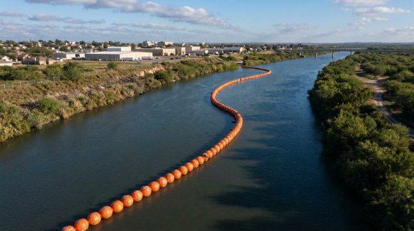









Texas and Mexico are fighting over nine islands along the Rio Grande but who really owns them?
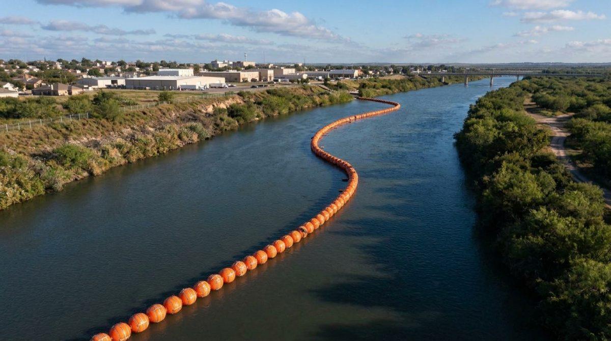
-
Nine islands in the Rio Grande spark a sovereignty dispute between authorities in the United States and Mexico, while diplomats demand strict adherence to international border treaties.
-
The Texas General Land Office pushes for surveillance operations on these river islets, although Mexican officials reject any unilateral alteration of the established boundary.
-
November midterm election results reshape the political landscape across Texas, while the International Boundary and Water Commission evaluates the exact location of each formation.
Bilateral tension escalates along the southern border as a fierce Texas and Mexico dispute unfolds over the legal ownership of nine islands sitting along the Rio Grande, known as the Rio Bravo across Mexican territory, where both national and state authorities claim jurisdiction over these river formations separating Texas communities from Tamaulipas, while the controversy intensifies sharply at the end of October right ahead of the United States midterm elections that reshaped the House of Representatives, 1/3 of the Senate and crucial local offices.
Furthermore, this immediate diplomatic friction begins on October 26 when the Texas General Land Office, led by Commissioner Dawn Buckingham, officially declares that these nine islands belong to state patrimony after examining historical maps, surveys and aerial photography, arguing that law enforcement agencies require direct access to conduct patrols, inspections and security operations against drug cartels, human smugglers, and traffickers, although the Mexican government immediately challenges this posture by affirming that no state administration holds legal authority to modify the international boundary line.
The nine islands contested along the Rio Grande channel
According to technical records published by the Texas General Land Office, the nine islands under contention cover a combined surface area of 66 acres, equivalent to 26.7 hectares distributed sequentially from north to south along the river channel separating Texas from Tamaulipas:
-
Nixon Island represents the largest single landmass within the disputed group by measuring exactly 21.7 acres, or 8.78 hectares, along the northern stretch of the river route.
-
La Bota Island marks the second geographic point heading southward and encompasses a total surface area of 2.89 acres, or 1.17 hectares, inside the border waterway.
-
Tex Mex 2 Island occupies a middle section along the river course with a clearly mapped surface area of 1.51 acres, or 0.61 hectares, under state review.
-
McKendricks Island stands as the second largest land formation on the official list by reaching exactly 18.41 acres, or 7.45 hectares, of total territory.
-
Lost Boot Island ranks among the smallest parcels in the border controversy with barely 0.49 acres, or 0.20 hectares, sitting directly inside the flowing current.
-
Clark Island presents a consolidated area of 3.61 acres, or 1.46 hectares, that state officials seek to integrate into routine law enforcement surveillance routes.
-
Zachary Island registers the third largest territorial dimension in the analyzed group by spanning a total area of 12.5 acres, or 5.06 hectares, along the border.
-
Miller Island shares immediate geographic proximity with its neighboring sister islet and covers a surface area of 0.49 acres, or 0.20 hectares, within the Texas inventory.
-
Miller 2 Island completes the southern end of the nine islands inventory by covering 4.5 acres, or 1.82 hectares, right beside Miller Island across from Tamaulipas.
What Texas and United States officials declare about border security
During an official announcement regarding state patrimony, Commissioner Dawn Buckingham proudly declared a major victory by confirming that the Texas General Land Office officially identified nine islands along the Rio Grande totaling approximately 66 acres, noting that ownership had remained uncertain for years and that this new jurisdiction grants both state and federal law enforcement full authorization to protect and clear these lands of any illegal activity.
Moreover, during an exclusive interview with the broadcaster One America News Network, Commissioner Buckingham asserts that taking operational control over these river formations enables American authorities to eliminate potential safe havens for cartels and ensure zero illegal activity takes place on state land, while later telling CNN that her agency compared the treaty boundary line with historical records, geographic surveys, and aerial imagery to conclude that the parcels sit squarely on the Texas side.
Meanwhile, reporters from CNN border coverage contacted both the United States section of the International Boundary and Water Commission and the United States Department of State regarding the diplomatic backlash, though neither federal entity has issued an official response yet, even as Texas politics undergo a historic upheaval during the November 3 midterm elections where Republicans lost their longstanding stronghold across the state.
Additionally, Democrat Benjamin Flores defeated Dawn Buckingham in the race for Texas Land Commissioner, prompting Buckingham to concede defeat on November 4 through a message on X where she declared she will never step away from public life and stated that from the ashes they will rise again stronger, more resolute, and more committed than ever to secure Texas for future generations, alongside major Democratic victories by Gina Hinojosa over Governor Greg Abbott and James Talarico over Ken Paxton in the Senate contest.
Ver esta publicación en Instagram
What Mexico declares under international border treaties
Mexico formally rejects the unilateral Texas claim on October 30 through an official statement from the Mexican Ministry of Foreign Affairs, emphasizing that no state government holds legal power to alter the international border and noting that the 1970 Boundary Treaty establishes the center of the Rio Grande channel as the dividing line while designating the International Boundary and Water Commission, known as IBWC or CILA, as the sole bilateral body authorized to determine island sovereignty and prohibit works that divert or obstruct normal river flow.
Consequently, the Mexican Foreign Ministry pledges to maintain close, punctual monitoring over any action in the region while reiterating its unwavering commitment to bilateral dialogue through established treaty mechanisms, and Mexican representatives before CILA confirmed to CNN that the delegation already took formal note of the matter and keeps the Foreign Ministry continuously informed.