

WATCH NOW
Watch on the app












California’s next major storm could bring a dangerous surprise beyond heavy rainfall
-
California storm regions experience escalating flood threats as Pacific moisture systems target vulnerable coastal and inland communities.
-
National Weather Service forecasters track an expansive tropical vapor plume capable of dropping heavy precipitation across northern valleys.
-
Emergency management agencies urge families to inspect drainage systems and stock essential supplies ahead of severe winter weather impacts.
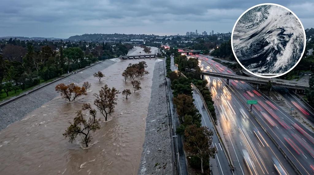
Residents across the state brace as the next atmospheric river could bring more than rain to these areas between Nov 13 and Nov 15, 2026, while this Pacific moisture plume aims to transport vast amounts of tropical vapor directly toward vulnerable northern and central corridors.
Official forecasts by the Climate Prediction Center outlined this major hydrological event threat; therefore, multi inch rainfall projections reinforce commitments toward proactive emergency preparations across coastal lowlands and the Klamath region.
Atmospheric river moisture surge impacts vulnerable northern valleys
California storm regions will experience extreme precipitation across northern coastal communities and high altitude zones, where thousands of commuter families prepare alongside local emergency responders to solidify regional safety strategies.
In addition, NOAA published reports on Nov 6 indicating a 40% to 60% probability of heavy rainfall; consequently, research meteorologists at the Center for Western Weather and Water Extremes released corresponding data showing a 60% to 90% chance of extreme moisture activity with estimates between 0.5 and 1.5 inches of rain to ensure continuous critical safety data flow.
There is a lot of misinformation on #ElNiño. You should be preparing your home, car, and workplace like any winter season. Understand what El Niño is. Obtain info from reputable sources. Visit https://t.co/HfiiR4vP2k to prepare. #CAwx #NationalPreparednessMonth https://t.co/oDnPWtCQha
— NWS Los Angeles (@NWSLosAngeles) September 25, 2026
California storm regions face heightened winter flood hazards
California storm regions face heightened vulnerability as NOAA predicts an 83% chance of a strong El Niño event for the 2026 to 2027 winter, matching historical ocean patterns observed since 1950 to highlight long term precipitation dynamics throughout the Central Valley.
Meanwhile, climate scientists reference the ARkStorm model and the historic 1861 to 1862 flood to contextualize current threats; thus, municipal public works departments cleared storm drains in early November after weather projections highlighted potential 2 inch rainfall totals in Sacramento, according to experts at the National Weather Service.
Strategic safety measures protect coastal and inland communities
-
California storm regions prep: Municipal crews inspect drainage channels, clear roadway culverts and deploy emergency sandbag stations to guarantee public safety readiness before heavy precipitation grounds transportation corridors.
-
Atmospheric river monitoring: High altitude precipitation estimates show heavy snowfall above 6000 feet to build vital winter water reserves for state reservoirs.
-
Coastal flood vulnerability: Regional emergency managers identify low lying neighborhoods facing elevated flood risks along riverbanks and advise drivers against crossing flooded streets.
-
Family emergency kits: Preparedness guidelines urge residents to clear residential storm drains and stock battery powered supplies to handle temporary power outages.
Proactive emergency planning ensures long term resilience against severe Pacific storm systems for California storm regions, whereas maintaining updated weather alerts establishes a decisive advantage for community safety against any incoming atmospheric river.
