

WATCH NOW
Watch on the app















Southern California faces new weather threat as rain gives way to warmer conditions
-
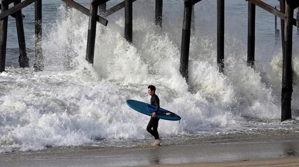
Warmer days ahead will define Southern California’s immediate weather outlook as Halloween rains depart while a fresh surf swell approaches the coast.
-
The National Weather Service forecasts dry weather and temperatures reaching 84 ℉ (29 ℃) before powerful ocean waves arrive.
-
Coastal communities maintain active surveillance ahead of the swift weather transition and rising weekend heat.
The Halloween storm system officially departed Southern California to make way for clear skies, marking the start of a swift weather transition with steadily rising temperatures; however, meteorologists warn about an imminent Southern California coastal threat that will directly impact beach communities toward the weekend, as offshore continental flows will push inland temperatures near 84 ℉ while the arrival of warmer days ahead promises to heat up inland valleys while local lifeguards monitor changing tides.
Consequently, the regional forecast combines pleasant conditions on land with hazardous ocean dynamics, as strong westerly and southerly winds stirred up turbulent seas over the weekend; therefore, the National Weather Service maintains active surf advisories for swimmers and surfers across coastal counties, whereas high ocean swells create severe rip currents along regional beaches while atmospheric scientists expect this temporary weather stabilization to serve as a prelude to a new cycle of ocean instability that will reach its peak intensity over the coming days.
Southern California coastal threat and shifting weather patterns
In addition, official logs from the National Weather Service Forecast Office Oxnard confirm that weekend storm cells dropped general rainfall totals between 0.25 and 1 in (6 to 25 mm) across most of the Los Angeles metropolitan area, reaching peak accumulations of 1.5 in (38 mm) across the San Gabriel Valley and the Ventura Oxnard Point Mugu corridor; as a result, precipitation ceased late Sunday night to yield dry skies that will last through Thursday, allowing the gradual arrival of warmer days ahead throughout the coastline, where dry atmospheric conditions will dominate coastal zones through Thursday while beach strips remain under continuous hazardous surf advisories as sustained westerly winds pushed dangerous waves that still affect recreational water activities and small vessel navigation.
Indeed, extended weather models indicate a brief maritime truce during Tuesday and Wednesday, but an active storm track over the North Pacific will drive strong northwesterly swells starting Thursday, creating a peak wave impact on Saturday; in fact, this system poses a direct threat to coastal communities that recently suffered severe beach erosion, while meteorologists at the National Weather Service San Diego Office clarified that recent rainfall generated minimal coastal erosion across vulnerable shorelines, although areas previously hit by heavy surf experienced minor damage that requires ongoing safety patrols.
Southern California weather transition: rainfall data and coastal hazards
-
Downtown Los Angeles averaged 0.7 in of total rainfall after the frontal passage.
-
San Gabriel Valley communities like Alhambra hit peak storm accumulations near 1.5 in.
-
The Ventura, Oxnard, and Point Mugu corridor averaged steady rainfall totals between 0.5 and 1.5 in.
-
Meteorologists confirmed the absence of flash flooding across Orange, Riverside, and San Bernardino counties.
-
The prospect of warmer days ahead ensures rapid ground drying ahead of offshore continental winds.
-
The approaching Southern California coastal threat will reactivate safety watches along vulnerable piers and seawalls.
Consequently, consolidated expert evaluations depict a controlled scenario regarding rainfall while urging caution over the combined effects of rising heat and marine instability; furthermore, the Oxnard weather team expects a high pressure ridge to take command of regional weather patterns starting Thursday, as Santa Ana wind gusts will compress air masses to drive temperatures higher, bringing weak to moderate offshore gusts that will trigger a sharp increase in maximum temperatures reaching into the 80s Fahrenheit right at the start of the weekend.
Geographic variations and warmer days ahead
The interaction between continental winds and high pressure will elevate heat risks to low and moderate levels near the coast, pushing thermometers to mid 80s ℉ (around 29 ℃); for this reason, public safety officials urge residents to take heat precautions during this sudden temperature shift following recent rains, while analysis published by the Climate Prediction Center indicates that these warmer days ahead will transform inland valley environments, creating a sharp contrast with the dangerous swells that will begin breaking heavily along beach zones as extended climate models suggest a returning wet pattern by mid November.
Equally, mathematical models suggest a potential wet pattern developing toward mid November, although scientists emphasize that long range rainfall predictions carry high uncertainty; nevertheless, emergency managers remain focused on the immediate Southern California coastal threat arriving Saturday, as emergency crews monitor marine advisories ahead of peak wave activity while the region prepares for dry, warm conditions under the active watch of the Southern California coastal threat.
