

WATCH NOW
Watch on the app














Texas’ sudden weather shift threatens a quiet weekend as rain and colder temperatures move in
- Meteorological forecasts confirm a sudden weather shift breaking the expected calm for the weekend in Texas.
- A low-pressure system combined with Pacific moisture brings freezing temperatures, a cold front of up to 50 degrees, and rain to San Antonio.
- Precipitation probabilities exceed 80%, severely affecting residents and communities across The United States.
The drastic meteorological turn threatening tranquility across the state
Initial projections anticipating a peaceful weekend vanished completely after confirmation of a severe weather shift in Texas, a phenomenon altering atmospheric conditions drastically across the entire southern region due to a powerful low-pressure system moving rapidly from the southern plains. Furthermore, this instability interacts directly with a moisture current coming from the Pacific Ocean to push temperatures down, forcing local communities like San Antonio to dust off coats and prepare umbrellas against the imminent plummet of thermometers down to the 50s and 60s Fahrenheit during this weekend.
In this sense, meteorologists warn that pleasant conditions registered during Thursday, when the mercury reached nearly 80 degrees in the San Antonio metropolitan area, give way to a cold front entering near midnight, shifting wind direction from the north and laying foundations for a stretch of days marked by water, rain and freezing temperatures across The United States.
Heavy rains and freezing gusts affect the center and south of the territory
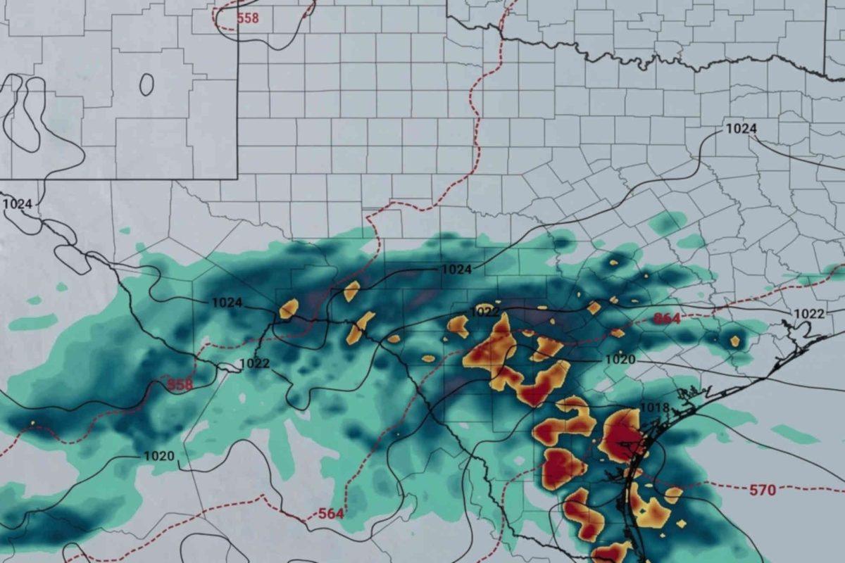
Similarly, as Friday progresses and northern wind gains strength with gusts reaching up to 30 miles per hour, environmental humidity increases significantly to trigger heavy precipitation and rains, marking the true impact of the weather shift in Texas and surrounding areas; additionally, rain probabilities climb to a range between 70% and 80% during Saturday night and Sunday early morning, accumulating between 0.75 and 1.5 inches of water in the urban strip of San Antonio, although in southern locations like Laredo, Corpus Christi, and the Rio Grande Valley, accumulations easily exceed 2 inches. Even though the lack of severe thermal instability avoids destructive thunderstorms, residents must stay alert for possible puddles and minor street flooding, since this marked adjustment in atmospheric patterns maintains cloudy skies and a distinct thermal sensation due to the cold front during most of the weekend across The United States.
Recommendations and regional impact facing low temperatures
On the other hand, the gradual retreat of low pressure toward mid-Sunday begins decreasing precipitation, but leaves behind the lowest temperatures registered in recent weeks in San Antonio, consolidating highs barely touching the 60s and nighttime lows near the 50s. Likewise, this marked meteorological transition, rains and weather shift in Texas demand taking road safety precautions and postponing outdoor events across the entire southern sector of the region, guaranteeing that families adapt smoothly to the notable drop in thermometers and cold front temperatures. Thus, understanding the scope and evolution of this abrupt phenomenon enables the population to react in time against adverse weather, reaffirming the importance of following updated informational bulletins to protect community well-being against nature’s strikes in the region.
